

Dunedin was the last stop on our cross-country road trip through New Zealand. This city has some great architecture, great food, and was central to many of the short trips we took around the Otago region of the South Island.

The city center of Dunedin is The Octagon, an eight-sided plaza with a one-way road through the middle.


“Dunedin was once New Zealand’s largest and wealthiest city, an important hub of commerce and trade. During these prosperous times, a great metropolitan centre of grand Victorian and Edwardian buildings was constructed, taking inspiration from the style, street names and layout of Edinburgh, Scotland.” – 100% Pure New Zealand

“Most of these buildings remain today, and it is said that Dunedin has the finest collection of Victorian and Edwardian buildings in the southern hemisphere.” – 100% Pure New Zealand


“The best way to truly appreciate the beauty of the city, is on foot. There are two inner city heritage walks to choose from, marked by bronze plaques set into the footpath, marked as ‘Heritage Walk 1’ and ‘Heritage Walk 2’.
Each walk is just over two kilometres in length and takes you past stunning churches, grand old hotels, a Victorian Gaol, the Dunedin Railway Station and many other fine examples of period architecture.” – 100% Pure New Zealand


Also in Dunedin is Baldwin Street, the world’s steepest street.

“Guinness World Records calls it the steepest street in the world, meaning no street gains more altitude in 10 horizontal metres (33 ft), measured along the street’s centreline.” – Wikipedia

“The street’s steepness was unintentional. As with many other parts of early Dunedin, and indeed New Zealand at large, streets were laid out in a grid pattern with no consideration for the terrain, usually by planners in London.” – Wikipedia


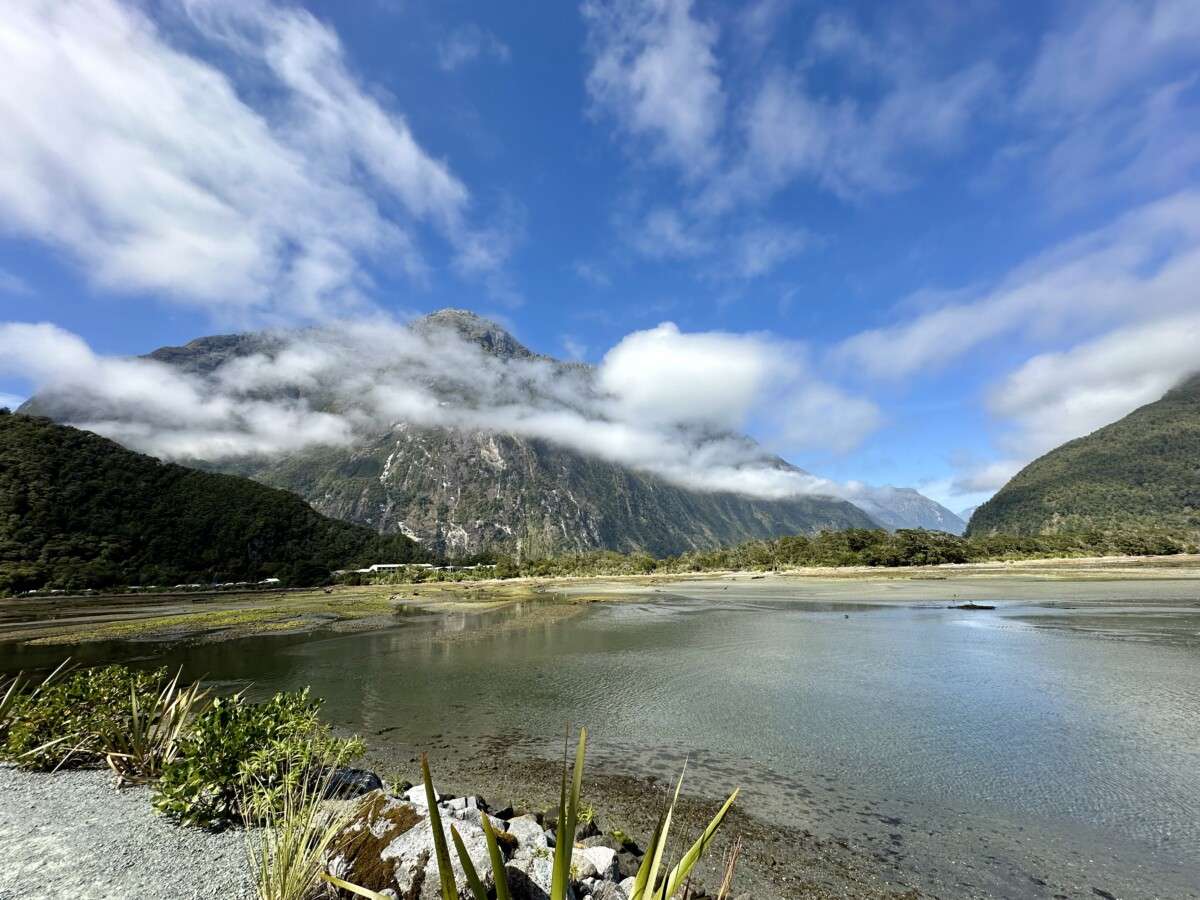
We stayed with some friends in nearby Port Chalmers, a short drive from downtown Dunedin. For anyone taking a cruise around New Zealand, this is where your ship will most likely dock.

We stayed with our friends, Peter and Monique, at the home of Peter’s brother, John, and his wife Bridget. They live in a neighborhood up in the hills. It was so peaceful, and yet it was really close to downtown Dunedin. We think they found the perfect place to build their home.


I don’t think I’ve mentioned this in any other post about New Zealand – Kiwis grow and shape some amazingly large hedges all over this country. I finally took a picture of one by John and Bridget’s house. If you come here and drive around you can see even taller ones on the north island.


As I mentioned earlier, Dunedin is a good central location to stay if you want to visit nearby towns and cities. One of our day trips was to visit nearby St. Clair Beach, about 10 minutes south of The Octagon. It is a very cute seaside town with cafes and shops. You can walk along the promenade, or sit on one of the benches, and watch the surfers take on the waves.


About an hour north of Dunedin is a small beach with a cafe and visitor center. It is also home to some very unique boulders.

“The Moeraki Boulders (officially Moeraki Boulders / Kaihinaki) are unusually large spherical boulders lying along a stretch of Koekohe Beach…They occur scattered either as isolated or clusters of boulders within a stretch of beach where they have been protected in a scientific reserve.” – Wikipedia

“The most striking aspect of the boulders is their unusually large size and spherical shape, with a distinct bimodal size distribution. Approximately one-third of the boulders range in size from about 0.5 to 1.0 metre (1.6 to 3.3 ft) in diameter, the other two-thirds from 1.5 to 2.2 metres (4.9 to 7.2 ft).” – Wikipedia

I read that these boulders began forming in marine mud, near the seafloor. Scientists aren’t quite sure how they are formed but they have determined, “the larger boulders, 2 metres (6.6 ft) in diameter, are estimated to have taken 4 to 5.5 million years to grow while 10 to 50 metres (33 to 164 ft) of marine mud accumulated on the seafloor above them.” – Wikipedia

Eventually, the sand around them erodes and they end up on top of the beach sand instead of in it.


About one and a half hours north of Dunedin (30 minutes past the Moeraki Boulders) is another unique place along the Pacific coast, the city of Oamaru.
“The town was laid out in 1858 by Otago’s provincial surveyor John Turnbull Thomson, who named the early streets after British rivers. – Wikipedia (We noticed one of the main streets is named Thames)

“Oamaru has been built between the rolling hills of limestone and short stretch of flat land to the sea. This limestone rock is used for the construction of local “Oamaru stone”, sometimes called “Whitestone” buildings.” – Wikipedia

“The Victorian precinct in the southern part of Oamaru’s main commercial district ranks as one of New Zealand’s most impressive streetscapes due to the many prominent 19th century buildings constructed from this material.

“In August 2016 Oamaru made it into the Guinness Book of World Records for the largest gathering of steampunks in the world: a term that was coined in the 1980s and is based on imagining inventions the Victorians might have created for the modern world.” – Wikipedia


This playground is enjoyed by kids of all ages.
In case you’re wondering, Yes, I did take a turn after Joel. It was a blast! Sadly, as the group’s unofficial photographer, I was having too much fun and didn’t get any video of myself.


We had a lot of fun playing and exploring down by the wharf and historic precinct. Also in Oamaru is another unique sight. “A colony of little blue penguins lives in a disused quarry on the harbour not far from the historic precinct. The penguins established themselves in the early 1990s, once the rock quarry had been closed in the 1970s, and in 1992 a group of volunteers started to help make the area suitable as a breeding habitat for the penguins and provide guided tours.” – Wikipedia

Here are some interesting penguin facts from the Ōamaru Blue Penguin Colony:
- Blue penguins are the smallest penguin in the world, standing at only 30cm (11.8 inches) tall.
- They normally live to around 8-10 years, though the oldest one at this colony lived to 21 years old.
- Blue penguins swim up to 50 km (31 miles) per day during breeding season to keep their chicks well fed.
- Blue Penguins come ashore in groups called rafts. This may be just a few penguins or over 100.
- Blue Penguins are only active on land at night.
For more interesting penguin facts, or to see either a live nest camera, or a live stream of the penguin viewing area, click here. Depending on when you view this live stream, you might have to scroll to an earlier time to see the penguins. I’ve seen quite a few heading down to the water around 6:00 a.m., just before sunrise, in the past week (it is early April as I write this).


Oamaru is also the finishing point (the “ocean”) of the Alps to Ocean Cycle Trail (known as the A2O) which goes from Aoraki / Mount Cook and ends here at Friendly Bay, next to Holmes Wharf. This trail is more than 300 km (190 mi) and descends from an altitude of 780 metres (2,560 ft) down to sea level.
How hard can it possibly be?!? – it sounds like it is all downhill. (hehe)

You can read about our visit to Aoraki/Mount Cook here.

About 2 hours away from Dunedin is the small town of Ophir (pronounced O-fer). We ended up staying here for a couple of nights in a very unique Air BnB that Peter and Monique found.

“This lovely old building was the former St Andrew’s Presbyterian Church, built in 1897.” – Ophir Thyme Accomodation


“Ophir was originally known as Blacks, when gold was discovered in Central Otago in 1863. Ophir’s population grew to over 1000 as it became the commercial and social centre of the district.” – Wikipedia


“Today, with a current population of around 50, the town is also known for the many original buildings still surviving including the restored Post and Telegraph Office.” – Wikipedia


What is hand-canceling? Hand-canceling means that instead of using a machine to cancel the postage, a postal clerk will manually stamp each envelope with a special rubber stamp.


A short 15-minute drive from Ophir is Alexandra, which is where our friend Peter grew up. “The town was founded during the Otago gold rush in the 1860s, and was named after Alexandra of Denmark.” – Wikipedia

“The Alexandra suspension bridge was constructed between 1879 and 1882 after the bridge at Clyde failed in the 1878 flood.” – Wikipedia

“Alexandra is one of the farthest towns from a coastline and experiences warm summers and cold winters compared to the rest of New Zealand, with summer temperatures that can reach the mid 30’s °C (mid 90’s °F) and winter lows that drop around −8.0 °C (18 °F) most years.” – Wikipedia

The nearest town to Alexandra is Clyde, just 7 km (4.3 miles) away. “The town could once claim to be the most populous in New Zealand during the height of gold fever.” – Wikipedia

“Clyde is fast becoming known as a tourist haven. The location is particularly attractive to those visiting the region’s many vineyards and orchards.” – Wikipedia

Here are some other fun, quirky, and/or interesting places we visited while exploring Central Otago.
Historic Hayes Homestead:

“Eben Ernest Hayes (4 February 1851 – 27 June 1933) was a New Zealand engineer and inventor who founded the Hayes Engineering works in Oturehua, Central Otago. He developed a wind turbine and manufactured wind pumps and agricultural tools for farms.” – Wikipedia


Ernest Hayes invented many tools still used today on farms. “Hayes’ farming products are now marketed by Tru-Test Ltd and include wire strainers, wire dispensers, fence post tools, crimping tools, crimping sleeves and farm gates.” – Wikipedia

“The family firm’s Invercargill store, E Hayes and Sons founded by Hayes’ son Irving Hayes in 1932, still exists as a hardware store; memorabilia from Southland inventor and motorcyclist Burt Munro (depicted in The World’s Fastest Indian) is displayed in the store’s museum.” – Wikipedia
You can read about our visit to Invercargill, and the E Hayes and Sons store here.

We were able to explore their home, which gave us a chance to spend some time learning about how they, and other New Zealanders, lived during the late 1800’s.

On a side note, we saw so many lavender bushes in Central Otago that were full of bees, just like the one below. The bees completely ignored us when we moved closer to get a better look. They were mesmerizing and made the lavender look alive.


Tallyho Woolcarding – a store that both cards and sells wool. It was interesting to see the huge machines doing this. I didn’t get any pictures of the wool carding machine but found this short video featuring Mo Rocca, which shows the machines and explains the carding process. It was very interesting to see it in person and have a chance to speak to the woman running the machine. Plus, the drive up to the building was beautiful.


While in the area we stopped at The Chatto Creek Tavern, a pub just a few minutes outside of Alexandra, and discovered a fun backyard.


Less than 2 hours from Dunedin, and about 40 km (almost 25 miles) south of Alexandra, is the small town of Roxburgh. Peter stopped to show us where we should get meat pies, one of his favorites, the next time we are in the area.

We saw and experienced so much during our trip to New Zealand. And then it was suddenly time to leave.

And just like that we were home again.

New Zealand is an adventure we won’t ever forget. Thank you to old and new friends who made our time here so special.


A trip that will always be a highlight for you both. Such wonderful scenes and you had such wonderful experiences…. Great to end the trip with so much friend time. You were all having such fun. The boulders were most interesting and loved the little blue penquins. Thanks for sharing your trip with us. June and Gene
A trip that will always be a highlight for you both. Such wonderful scenes and you had such wonderful experiences…. Great to end the trip with so much friend time. You were all having such fun. The boulders were most interesting and loved the little blue penquins. Thanks for sharing your trip with us. June and Gene
Pura Vida and ATA Marie to Jeri and Joel,
Reading through this last post about your New Zealand adventure, I can surmised you spent the most time in Dunedin compared to all the other posts! But of course it was all worth it…. Beautiful place with so much to see and do… which you did!!! Love the steepest street in the world for excellent exercise, nature’s wonder how those spheres (perfect shape) came into being and what on earth did that cute foot tall blue penguin outlived so many in the colony!!! Last but not least, perfect toast for the evening after dinner with your friends, and then more!
Rod and Sasha
Wow!. You did such a great job logging all the experiences and photos that I felt like I was back there reliving it again! Thank you Jeri, great blog!!
The pictures are exceptional! What a fantastic travel experience you two are having.